These are links for JPSS imagery

    JPSS Realtime and Near-Realtime Imagery

  • JPSS Mapper from NOAA.gov
  • Direct Broadcast output from Antenna in Honolulu
  • Direct Broadcast output from Antenna in Miami
  • Direct Broadcast output from GINA in Fairbanks
  • CIRA Polar Slider.
  • You can find some Polar Data for surface properties at this STAR website: Link. Vegetation Health, for example, or Greenness, or Fire Risk.
  • Gridded NUCAPS fields for the past 48 hours from SPoRT.
    • CONUS domain
    • Caribbean Domain
    • Northern Hemisphere
    • Alaska Domain
  • You can find Global Gridded ozone NUCAPS fields for the past 48 hours at this website from SPoRT.
  • You can find Advected NUCAPS fields (including past events) here also from SPoRT.
  • NOAA (including JPSS) Flood product website: Click Here.
  • Flood Product archive is at this website
  • SSEC/CIMSS has the VIIRS Today website that includes True-Color, False-Color and Day Night Band imagery from Direct Broadcast sites over CONUS.
  • CMORPH-2 Data can be found at this Real-Earth site.
  • Microwave-based Snowfall estimates are here.
  • This site from Finland (Kiitos!) has OMPS and OMI data from Finland and Alaska (GINA).
  • SO2 monitoring.
  • Jorel Torres at CIRA has a data page of JPSS products and information too!

    NUCAPS Sounding Information

  • NUCAPS Soundings over the Globe
  • Rebekah Esmaili, Emily Berndt and Nadia Smith put together a most excellent Webpage about all things NUCAPS, including Data!
  • A long YouTube video on NUCAPS from 2014, from Chris Barnet is here
  • NUCAPS Training Video
  • Another (the latest!) NUCAPS Training Video -- including information on NUCAPS and Gridded NUCAPS in AWIPS.
  • Gridded NUCAPS Variables
  • NUCAPS and SharpPy information
  • NUCAPS at the CIMSS Satellite Blog.
    • Moist air over the western Pacific Ocean
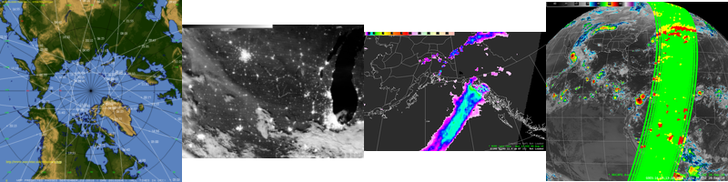
    • Thunderstorms over the Chukchi Sea and Beaufort Sea north of Alaska
    • Convective nowcasting over Wisconsin with NUCAPS
    • Displaying all NUCAPS profiles from a single granule
    • Tropical Storm Elsa forms in the Atlantic
    • Rapid Convective Initiation and NUCAPS Profiles in the upper Midwest
    • Unstable air comes to Madison
    • NUCAPS lapse rates as showers develop over the upper Midwest
    • Thunderstorms northeast of Guam
    • Tropical Depression (update: Tropical Storm Surigae) over the western Pacific
    • NUCAPS' description of a post-frontal atmosphere
    • Monitoring severe weather as it happens
    • Monitoring dry air with NUCAPS in advance of a storm
    • Using NUCAPS data to judge model performance before a storm
    • Using NUCAPS lapse rates to evaluate atmospheric stability
    • NUCAPS fields across an upper-tropospheric front
    • Severe weather in southeast Texas
    • Comparing NUCAPS temperature values to forecast fields
    • NUCAPS Sounding profiles surrounding Colorados East Troublesome Fire
    • Tropical Storm Epsilon in the Atlantic
    • NOAA-20 sounder observations of the atmosphere during a downslope event
    • Upper-tropospheric stability around wildfires
    • NUCAPS Lapse Rates ahead of a line of convection in lower Michigan
    • Using NUCAPS soundings in and around fire locations
    • NUCAPS diagnoses of stable air near Tropical Storm Marco
    • Using CSPP QuickLooks and Direct Broadcast data to view gridded NUCAPS fields
    • NUCAPS Soundings and microwave-based and GOES Level 2 Rain Rates
    • Using NUCAPS to help nowcast Midwest convection
    • Where will convective initiation occur? NUCAPS can help
    • Thunderstorms with abundant hail over southwest Oregon
    • Strong tornado through Nashville, Tennessee
    • Comparing gridded NUCAPS data to model data
    • Gridded NUCAPS over the Southeast United States
    • Can you use gridded NUCAPS fields to diagnose the rain/snow line?
    • Ozone Estimates from NUCAPS
    • Gridded NUCAPS Fields over the Pacific Ocean
    • Can you use NUCAPS data to find the rain/snow line?
    • Gridded NUCAPS in AWIPS, part II
    • Gridded NUCAPS in AWIPS
    • Displaying NUCAPS fields at one horizontal level using Polar2Grid
    • Using NUCAPS soundings to nowcast convective evolution (Michigan case)
    • Using NUCAPS soundings to nowcast convective evolution (Arkansas case)
    • NUCAPS soundings surrounding an isolated Thudershower
    • NUCAPS soundings are back in AWIPS
    • NUCAPS Sounding Availability
    • NUCAPS Profiles across a Saharan Air Layer (SAL) Outbreak
    • Comparing NUCAPS and GOES-16 Stability Estimates in the Caribbean
    • Using NUCAPS over the Tropical Pacific
    • Using NUCAPS to view Saharan Air Layer
    • Typhoon Soulik in the northwest Pacific Ocean
    • Comparing NUCAPS and GOES-16 Vertical Profiles
    • Sequential NUCAPS Profiles at Higher Latitudes

    Microwave Integrated Retrieval System

  • MIRS Products
    • List of Microwave Instruments on different satellites, and whether they are used in MIRS now.
    • Algorithm Description
    • Vertical Cross Sections
  • Daily Global Mirs Products
  • More MIRS Products
  • Gridded NUCAPS Variables
  • MIMIC Total Precipitable Water (various domains can be chosen).
  • Advected Layer Precipitable Water (ALPW) fields from CIRA
    • CONUS (really, extended CONUS!)
    • South America
    • Alaska and N. Pacific
    • Global

    JPSS Calibration

  • List of VIIRS Channels from CIRA.
  • Science documents for JPSS (ATBDs)
  • JPSS Data Products Operational Matrix

    JPSS data can be found on CLASS

  • NOAA CLASS Need to register. More info (Once you get to that website -- use the pull-down menu to find the relavent JPSS product)

    (Free) Software

  • McIDAS-V (UW Madison)
  • SSEC's HYDRA (use single band CMIP files)
  • NCview a netCDF visual (quicklook) browser
  • CSPP Community Satellite Processing Package for Direct Broadcast Antenna Polar Data
  • Integrated Data Viewer (IDV) (UNIDATA)
  • Panoply from NASA.
  • Polar2Grid is a Python-based software package that can create imagery from CLASS data.
    • How to display JPSS imagery from VIIRS using Polar2Grid
    • How to Create True-Color Imagery from VIIRS using Polar2Grid

    (Free) Phone apps

  • Real Earth apps
  • WxSat Android
  • MapSat (CPTEC/INPE) iOS
  • MapSat (CPTEC/INPE) Android

    JPSS Training / Education

  • The Promise of JPSS video.
  • JPSS Explained video.
  • List of VIIRS Channels from CIRA.
  • Parallax WebApp. Parallax affects the limb of JPSS scans too!
  • Training Resources at the NOAA JPSS Site
  • The NOAA JPSS Site
  • Website of AMS 2021 Short Course.
  • Polar Orbit Tracks from the SSEC Data Center.
  • Quick Guides on JPSS Products (Note: Some of these are also available through the NOAA VLab STOR at this website)
    • MIRS Skin Temperature (Data are available Here)
    • MIRS Snow Cover (Data are available Here)
    • VIIRS Ice Surface Temperature (Data are available Here)
    • VIIRS Ice Concentration(Data are available Here)
    • VIIRS Ice Thickness(Data are available Here)
    • VIIRS Flood Areal ExtentData are available Here)
    • VIIRS Volcanic Ash DetectionData are available Here)
    • NUCAPS Soundings(Data are available Here)
    • Near-Constant Contrast Day Night Band Imagery(Data are available Here; other DNB imagery Here)
    • VIIRS Day Land Cloud RGB(Data are available Here)
    • Snow Cloud Discriminator RGB(Data are available Here)
    • VIIRS Fire Temperature RGB(Data are available Here)
    • JASON Significant Wave Height(Data are available Here)
    • GCOM AMSR-2 Sea-Surface Winds(Data are available Here)
  • AMSR-2 on JAXA's GCOM Satellite.
  • CIMSS Satellite Blog
  • CIRA Loop of the Day
  • Satellite Liaison Blog
  • VISIT Meteorological Blog at CIRA.
  • There was a JPSS Summit in Alaska in May of 2018. An agenda of that 2-week meeting is here. A compiled list of Training Documents valid in 2018 is available here as a word document (Thanks to Jorel Torres, CIRA, for this compilation).

    JPSS Training in Videos

  • JPSS Advocacy Channel 01: How to find where Polar Orbiters fly overhead.
  • JPSS Advocacy Channel 02: How do you request VIIRS data at NOAA's CLASS Archive (Link to the CLASS Archive is here.)
  • JPSS Advocacy Channel 03: What you do after getting an email notification from CLASS that says your data are ready!
  • JPSS Advocacy Channel 04: How to display VIIRS data in McIDAS-V (Download McIDAS-V here.)
  • JPSS Advocacy Channel 05: How do you call up NUCAPS Soundings in AWIPS (A knobology video!)>
  • JPSS Advocacy Channel 06: A Short Review on NUCAPS Soundings and how they are useful
  • JPSS Advocacy Channel 07: A Short Review on Microwave Rain Rate in AWIPS and why it is useful
  • JPSS Advocacy Channel 08: SatPY Visualization of NOAA-20 Visible Imagery
  • JPSS Advocacy Channel 09: JPSS Estimates of Volcanic Ash
  • JPSS Advocacy Channel 10: MIRS Total Precipitable Water
  • JPSS Advocacy Channel 11: MIRS Sea Ice Concentration
  • JPSS Advocacy Channel 12: MIRS Snow Water Equivalent
  • JPSS Advocacy Channel 13: GCOM AMSR-2 Winds
  • JPSS Advocacy Channel 14: Recorded Training on NUCAPS Soundings
  • JPSS Advocacy Channel 15: JASON Wave Heights
  • JPSS Advocacy Channel 16: Blended Total Precipitable Water
  • JPSS Advocacy Channel 17: NUCAPS and Gridded NUCAPS over Alaska
  • JPSS Advocacy Channel 18: General Information on Retrievals
  • JPSS Advocacy Channel 19: MIMIC Total Precipitable Water fields
  • JPSS Advocacy Channel 20: Find VIIRS Products on CLASS, and VIIRS Granules in the JSTAR Mapper

  • The CIMSS SDOC Blog has JPSS-centered imagery on important weather events.

    If you want to see a similar page for GOES-16, I suggest this one created and maintainted by Tim Schmit, NOAA/STAR.

    The upkeep of these links is a best effort basis only. Only links for free imagery are included.

    To suggest needed updates: E-Mail Contact Form